Monday, May 23, 2011

Goldstream Wildfire Update #2


Containment is 60% as of approximately 2 pm today. The burned area is mapped at 941 acres, a little larger than the estimated 700 acres.


Details:

Coordinate Position
Geographic: 64° 56' 55" N, 147° 55' 54" W
Legal: SEC 3, T1N, R2W, FM
Elevation: 331 Meters or 1089 Feet
Slope/Aspect: 6°/106°
16 Active WildFires
Fire Name: Moose Mountain
Daily Record For: May 22, 2011
Status: S/U
Estimated Acres: 941
Incident Commander: Blankenship, C
Personnel Count: 211
Daily Cost: $268,703.00
Summary:
On 5/21/11 the fire was reported to be 800 acres with 60% contained. Fire had one sustained flare up and crowning for 70 acres, there was ground fire and group torching. Acitivities on the fire was continuation of cutting and securing fire line aided by ground crews and aerial resources. On 5/22 the fire transitioned to a Type 2 management team and cloudy AM weather and high RH`s allowed time for arriving resources to get established on the fire. A public meeting was held for the Goldstream community at 1900 on 5/22.
Fire Year: 2011
Sequence #: 160
Estimated Acres: 941
AFS Code: F3Z1
DOF Code: 111160
USFS Code: PNF3Z1
Total Cost: $340,703.00
Structures Threatened: 0
Structures Burned: 0
Management Org.: DOF
Office: FAS
Option: CRITICAL
Latitude: 64.9477768
Longitude: -147.9311066
Origin Owner: BORO
Origin Admin Unit: BORO
Discovery Time: May 20, 2011 3:49:00 PM
Discovery Size: 0.3
Initial Behavior: Rank 6
Primary Fuel Type:
Mixed (Hardwoods/Softwoods)
Fire Type: Unknown
Specific Cause: Unknown
Origin Slope: 0-25
Origin Aspect: Unknown
Origin Elevation: 501-1500
Township: 2N
Range: 2W
Section: 33
Quarter: SESE
Meridian: Fairbanks
Updated: May 22, 2011

Saturday, May 21, 2011

Goldstream Wildfire Update

InciWeb updated at about Noon indicated containment at approximately 10%.

Goldstream Fire #160: Fire map shows MODIS detected hot spots (red squares) and reported location of fire. A fire extent will be available when they visually map the area from the air (possibly sometime Monday).


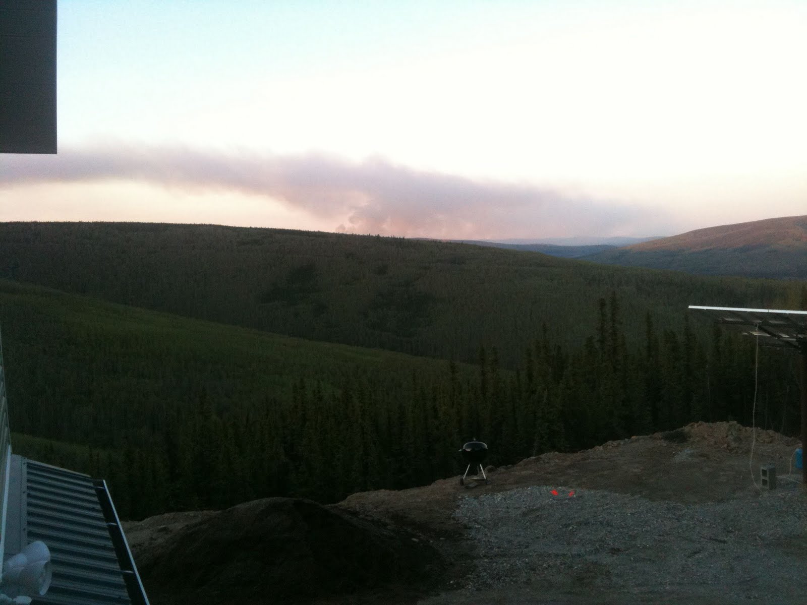
View from Lincoln Creek at 1 pm. Plume activity is greatly reduced. The overall forest fire season is long from over. Helicopter and plane activity can still be heard. This mornings report indicated that 125 staff are on the fire with more crews in route.


Fire Name: Moose Mountain
Daily Record For: May 20, 2011
Status: S/U
Estimated Acres: 700
Incident Commander: Blankenship, C
Personnel Count: 125
Daily Cost: $72,000.00
Summary:
At 1531 59633 reported a large column of smoke. Helitack arrived on scene and found 1/4 acre fire burning in black spruce 100% percent active in black spruce with trees torching. Air Attack, Retardant, Smoke Jumpers a Scoopers, Crews and Dozers were ordered for the fire. Surrounding VFD`s provided engines and staging was set up at Ivory Jacks. Fire operations will continue thru the night. IC + 124
Fire Year: 2011
Sequence #: 160
Estimated Acres: 700
AFS Code: F3Z1
DOF Code: 111160
USFS Code: PNF321
Total Cost: $72,000.00
Structures Threatened: 0
Structures Burned: 0
Management Org.: DOF
Office: FAS
Option: Critical
Latitude: 64.94775
Longitude: -147.9311667
Origin Owner: BOR
Origin Admin Unit: BOR
Discovery Time: May 20, 2011 3:49:00 PM
Discovery Size: 0.3
Initial Behavior: Rank 6
Primary Fuel Type:
Mixed (Hardwoods/Softwoods)
Fire Type: Unknown
Specific Cause: Unknown
Origin Slope: 0-25
Origin Aspect: Unknown
Origin Elevation: 501-1500
Township: 2N
Range: 2W
Section: 33
Quarter: SESE
Meridian: Fairbanks
Updated: May 21, 2011

Friday, May 20, 2011

Goldstream Wildfire Breaks Out!

10:30 pm: Wind shift moves smoke into Goldstream Valley. We can still see planes circling the area. A more complete update and summary should appear on the AICC site tomorrow.


Goldstream fire as seen from Lincoln Creek subdivision:


Goldstream fire as seen from bend in Spinach Creek near railroad crossing:


Coming home from work, we encountered a wildfire that is reported by the Fairbanks News Miner to be along Old Murphy Dome Road. We can see the smoke plumes. More to come as we find out more.


Rebooted the iPhone, nothing wrong with the cell tower. Internet access is working too.

An incident command center has been established at the Goldstream Store on Goldstream Road by Ivory Jacks.

Information:

Moose Mountain Fire (#160)


Tuesday, May 10, 2011

A cold day to dye

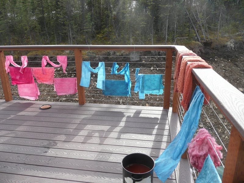
A couple friends came over and we got out the dye pots. Much fun and color was had by all:


We started with some mordanting and the fiber on the lines became rather stiff:


Yes, those are icicles against some madder-dyed silk.

I haven't stopped dyeing yet:


The pink is one batch, the rest are for a Fair Isle sweater. I figure if the swatch doesn't work out, there are always other colors to try at the yarn store. The colors here are indigo blue, walnut tan, marigold gold, alkanet grey, and cochineal pink to red.

Wednesday, May 4, 2011

Canyon update

Someone asked if the canyon is gone yet. Not quite! There has been melting, though.


And some freezing:

Tuesday, April 26, 2011

Canyon

We finally signed up for Netflix and guess what Rob does with his evenings? He's dug a grand canyon - view from above:


You can see the posts for the septic field in both images. The second is from ground level, with the hose for scale. Yes, we got a bit more snow this past winter than the winter before and it all piled up here between the house and the hillside, plus farther back. At least it wasn't drifting onto the driveway!


By the way, we can watch Netflix by download, but our network connection is such that it takes an hour to watch a half hour show. There are pauses of random duration. If you manually pause it, it loses its place and has to download again.

Sunday, April 24, 2011

It's melting

This picture was taken a couple weeks ago and shows several things: 1. it's light before work, 2. it's still cold, and 3. the seal on a triple-paned argon-filled window has failed.


On to today, Rob's weekend fun has been moving water around. He's got a little pump set up to pull from one hose, push to another. There's a Y so you can pull from puddle A (bottom of driveway) or puddle B (near front door). He said there was a while yesterday afternoon when the driveway puddle was filling faster than he could drain it.


Why bother? Last year the gravel under the porch supports liquified and the porch sank significantly.


The blue tarp is on the wood pile.


The stream flows over the edge of the cliff back by where we store the canoe.